P-3 “Dumbo”
Description of the radar set, tactical-technical characteristics
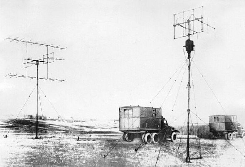
Figure 1: The mobile P3M- sersion, (Antenna left), source: Nitel-Museum

| Specifications | |
|---|---|
| frequency: | VHF–Band |
| pulse repetition time (PRT): | |
| pulse repetition frequency (PRF): | |
| pulsewidth (τ): | |
| receive time: | |
| dead time: | |
| peak power: | 55 kW |
| average power: | |
| instrumented range: | 120 km |
| range resolution: | 2.5 km |
| accuracy: | |
| beamwidth: | 24° |
| hits per scan: | |
| antenna rotation: | |
| MTBCF: | |
| MTTR: | |
P-3 “Dumbo”
The first Soviet radar unit to the determination of 3 coordinates was built approximately end of the World War II. The radar station was called “Pegmantit 3” - or abbreviated for P 3. There were two modifications: a mobile (P-3M) and a fixed site (P-3A) version. The mobile version was built in containers on two trucks. The transmitter and and the receiving system were put in a separate container. The display still was an A-scope.
If the display is an A-scope only, this radar cannot rotate quickly. It has to be assumed that the turn was manually carried out (like a direction findig equipment by radio-monitoring). Otherwise the given accuracy in azimuth isn't concurring with the poor antenna gain of a single pair of Yagi-antennae to be expected.
The elevation angle was determined with a so-called “Goniometer” in older Russian VHF radars (e.g. the “Knife Rest” series). For this the radar unit has got two antennae (or groups) one above the other. The phase difference between the antennae is the measure of the targets elevation angle. The Goniometer produces a standing wave of the received RF impulses on two slip rings fed by the two Yagi- antennae. Two simultaneously moving measuring contacts on the slip rings measures the voltage difference between the slip rings. This voltage difference gets the value zero in a certain position. The mechanical angle of this position corresponds to the elevation angle of the target. With a nomograph the elevation angle could be converted to a height value in connection with the measured range.
Accuracy:
- of the azimuth determination: 4°
- of the range determination: 1,5 km
- of the height determination: 1,5
Source: G. Nitschke, K.-H. Lau, “Von der visuellen Luftraumbeobachtung zur elektronischen Luftraumaufklärung”
in: “Militärwesen” 7/72 - Ausgabe B (Luftstreitkräfte) Militärverlag der DDR
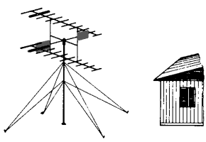
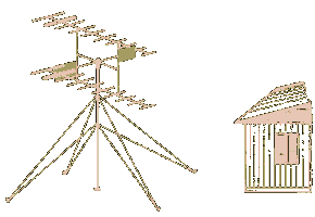
Figure 2: An artists impression of the fixed site P3A-version