Vertical Height and Altitude Definitions
- Geoid Mean sea level is the surface of equal gravity that best fits the average sea surface over the entire earth. This irregular but smooth surface shall be called the geoid.
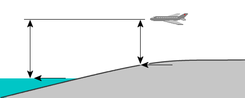
- Geoidal Height Geoidal height is the height of a particular point on the geoid above or below the WGS-84 ellipsoid, measured along a line that passes through the point on the geoid and is normal to the surface of the ellipsoid.
- Orthometric Height Orthometric height is the height of a point on the physical surface of the earth above or below the geoid, measured along a line that passes through both the point on the earth and the point on the geoid and is normal to the surface of the WGS-84 ellipsoid. This is the height usually found on geographic maps for ground elevation.
- Orthometric Altitude Orthometric altitude is the height of the airplane above or below the geoid, measured along a line that passes through both the airplane and the point on the geoid and is normal to the surface of the WGS-84 ellipsoid.
- Geodetic Height Geodetic height is the height of a point on the physical surface of the earth above or below the ellipsoid, measured along a line that passed through the point on the earth and is normal to the surface of the WGS-84 ellipsoid.

Figure 1: Height and altitude

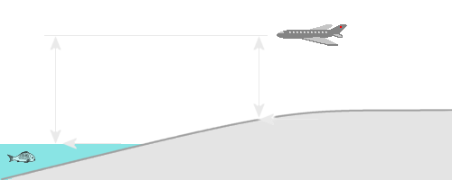
Figure 1: Height and altitude
- Geodetic Altitude Geodetic altitude is the airplane distance above or below the ellipsoid as measured along a line that passes through the airplane and is normal to the surface of the WGS-84 ellipsoid.
- Pressure Altitude Pressure altitude is the airplane distance above mean sea level (the distance above the geoid) on a standard day.
- True Altitude True altitude is the actual airplane distance above mean sea level (the actual distance above the geoid).
- System Altitude The MCDU indication of the airplane height above the geoid shall be called SYSTEM ALTITUDE. SYSTEM ALTITUDE is an approximation of true altitude.
The following words shall be used as a prefix to indicate the source of an altitude measurement:
- Barometric shall mean the altitude derived from air data (air data computer).
- Baro-Inertial shall mean the altitude from the INU. (A complementary filter in the INU shall operate on barometric pressure altitude and vertical acceleration to determine an optimal estimate of altitude.)
- GPS shall mean the altitude from the GPS receiver.
Height Above Ground Level The airplane height above ground level (or ground clearance or vertical range) shall be the vertical distance between the airplane and the ground directly below the airplane. This distance is equal to the difference between orthometric altitude and orthometric height, and is also equal to the difference between geodetic altitude and geodetic height.
Height Above the Target The airplane height above the target (or target clearance or the target vertical range) shall be the vertical distance between the airplane and the ground elevation of a target or sensor aiming point.
