Precision Approach Radar
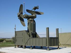
Figure 1: Precision Approach Radar PAR 2090 (© 2011 Selex System Integration)
What is PAR?
Precision Approach Radar
Precision Approach Radar (PAR) is a primary radar used at aerodromes for approach operations based on specific procedures for the pilot and the controller; however, the use of PARs for civil applications is rapidly decreasing.[1] Precision Approach Radar offers the possibility of a safe landing even in poor visibility conditions. The radar is placed near the mid-point of the runway (at a distance up to 6.000 ft) and works remotely. The radar is particularly important in situations when the pilot has limited sight (because of fog, rain, etc.). In this situation, the radar has to provide the approach controller with maximum quality radar display complemented by computer evaluation of speed, deviations from glide path (or glide slope) and course line, the distance from the previously approaching aircraft, etc. The controller issues azimuth and elevation advisories to the pilot until the aircraft reaches the elevation decision height point, approximately one-half mile from the touchdown point.
The advantage of the classical method of transmitting the instructions by radio, the so-called “talk down”, is its general applicability, because no additional equipment in the aircraft is needed.
The technical parameters that a precision approach radar should meet are referred to in a Recommendation of the International Civil Aviation Organization (ICAO). This recommendation includes minimum requirements for technical parameters as well as site conditions.[2]
A precision approach always needs height-finder capabilities. An instrument approach and landing which utilizes lateral guidance (e.g. by a 2D radars but does not utilize vertical guidance, is called non-precise.[3][4] In this case, depending on the distance measured by the radar, the respective nominal altitude is determined at regular intervals by the air traffic controller from a table and communicated to the pilot by radio.
Application
All the PAR radar systems are capable of providing approach information to multiple runways when mounted on a turntable which serves to realign the radar antenna to the desired runways. However, only one direction can be served at the same time. The antenna of the Precision Approach Radar is always pointed toward the approach end of the runway to provide radar coverage of inbound aircraft in the airfield landing pattern.
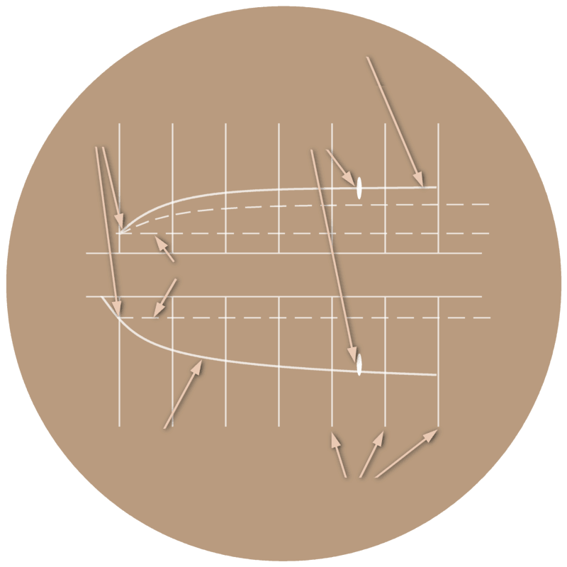
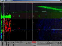
The detected information is displayed on workplace screens and radar information is transferred to remote ATC workplaces. Approach controller consoles can be situated either in the ATM center, the control tower or in radar container. The radar information is displayed on a beta scan scope. A number of cursors and marks are displayed in addition to the current position of the approaching aircraft. The air traffic controller can see from this the necessary instructions to the pilot.
Necessary course corrections are sent with the phrase: “Your course is slightly left (…right).” The pilot can then correct his flight direction. If the flight direction is correct, this is confirmed with the phrase “on course”. Necessary corrections of the altitude are sent with the phrase: “…slightly above (…below) glidepath.” If the course and the altitude are correct, then this is the phrase “On course, on glidepath”.[5]
These types of radars must be calibrated by a flight inspection at each location periodically. This flight check is carried out with a small aircraft whose approach is held by radar as accurately as possible on the ideal course and glideslope. At the same time, deviations during the approach are documented with a high-resolution video camera fixed on the end of the runway and watching this glide path. The given commands to the pilot are recorded as a soundtrack to the video. A possible deviation of the radar (for example, due to incorrect adjustment or squinting antennas) can be detected during the evaluation of the video.
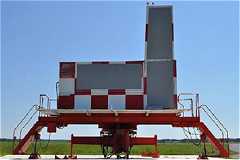
Figure 2: Raytheon's AN/FPN-63 Precision Approach Radar uses phased array antennas but is also divided into two independent radars as shown in Figure 1.

Figure 2: Raytheon's AN/FPN-63 Precision Approach Radar uses phased array antennas, but is also divided into two independent radars as shown in Figure 1.
PAR using two 2D-Radars
In the era of the predominant use of 2D radars, the precision approach radar consisted principally of a combination of two identical radars operating at slightly different carrier frequencies (mostly using X-Band). They use two parabolic antennas rotated by 90 degrees to each other, each providing a narrow fan beam. This classic design is still used in modern radars since this type of radar is a very low-cost version.
The transverse antenna is responsible for the course. This part of the radar antenna pivots in a sector of about 10 degrees to the left and to the right and explores the lateral deviations from the ideal course to the runway.
The upright reflector is responsible for the glide path. This part of the antenna is nodding in elevation in the range of from -1 degree to 8 degrees or up to 15 degrees. The display shows the deviations in the current altitude.
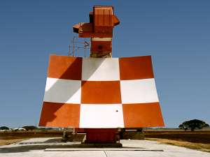
Figure 3: Raytheon's AN/GPN-22 uses a reflector antenna with a phased array as the primary radiator.

Figure 3: Raytheon's AN/GPN-22 uses a reflector antenna with a phased array as the primary radiator.
PAR using a single 3D-Radar
With a 3D radar, the parts that used to work as two separate radars can be united in a single radar that uses only a single antenna. There are two possibilities:
- The radar moves the antenna in one dimension mechanically, and in the second dimension, there is an electronically beam-deflection. An example of this is the nodding antenna of the PAR-80, using electronically beam-deflection of a Pencil-Beam in azimuth
- The second way is to completely dispense with a mechanical pivoting and to use electronically beam-deflection in both dimensions. An example of this method is Raytheon's AN/GPN-22 (Figure 3). (The ability to rotate the antenna is only used to serve several different runways.)
Instrument Landing System
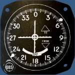
The precision approach radar (PAR) is not an instrument landing system, and the instrument landing system (ILS) is not a radar method. However, there are precision approach radars in whose main antenna is integrated such an instrument landing system (e.g. the AN/TPN-22). ILS is a navigation aid for the pilots, to which additional avionics equipment must be installed in the aircraft. From a transmitter on the airfield are emitted direction finding beams, which are received in the aircraft by a receiver. The course deviations are displayed to the pilot on a course deviation indicator (CDI). ILS allows it to touch down at airfields without staff from that airfield being involved to ensure landing.
Picture gallery of Precision Approach Radar
Sources and ressources:
- ICAO: Global Air Navigation Plan for CNS/ATM Systems, Second Edition — 2002, Chapter 7 Surveillance Systems (online)
- ICAO: Annex 10 - Aeronautical Communications, Volume I, Chapter 3, Item 3.2.3: The precision approach radar element (PAR), page 3-25 (PDF-page 33)
- ICAO: Annex 6 - Operation of Aircraft, Part I, Chapter 1, Definitions, page 1-1 (PDF-page 25)
- ICAO: NON-PRECISION INSTRUMENT APPROACH, in Advisory Circular for Air Operators, November 2012, AC No: 008A-CDFA, page 3 (online)
- U.S. DEPARTMENT OF TRANSPORTATION, Air Traffic Organization Policy: Air Traffic Control, Section 12. PAR Approaches− Terminal page: 5−12−1 (online)

