Radar Beta-Scan-Scopes

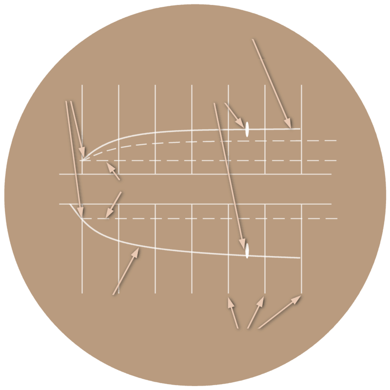
Elevation cursor
Touch down
Target
on course
on course
Safety cursor
Azimuth cursor
Range marks
Figure 1: View of a Beta-Scan-Scope
Radar Beta-Scan-Scopes
The by
Precision Approach Radar
(e.g. by the
PAR-80)
found radar information is shown in a Beta Scan Scope
with two “pictures”:
The upper picture is a side view of the landing approach up to the touch down point on the runway
with an imaginary line as a reference. This upper picture shows the data determined by the antenna to the height scanning. It also
is called Elevation-Picture therefore.
The top view of the imaginary prolongation of the center line of the runway, the touchdown and the range marks, is corresponding in the lower picture. This lower picture shows the data recorded by the antenna to the horizontal sector scanning. Also it is named Azimuth-Picture therefore.

